The Glad Tidings Plain, Jacobs Meadow Lehner Conservation Area consists of 100 acres of contiguous open space extending from the rear of Main Street house lots on the west to the Fulling Mill Brook on the east, and from the rear of Crooked Meadow Lane house lots on the north to South Pleasant Street and beyond to Fulling Mill Pond on the south.
Located in the heart of the Weir River Watershed, the acreage includes open fields, streams, hills, and varied woodlands. To the east the watershed boundary between fulling Mill Brook and Accord Brook, generally follows Lazel Street and the boundary to Wompatuck State Park. To the west the watershed boundary with Crooked Meadow Brook generally follows Main Street. Fulling Mill Brook and Crooked Meadow Brook meet south of Free Street to form the Weir River.
The property lots laid out in colonial times from Main Street were long and narrow running from Main Street to Fulling Mill Brook. This layout provided each lot with access to the street and water in the brook and the land between the two for farming. As a result, most old stone walls on the land run from west to east. The exception is property fronting on South Pleasant Street where the lots and stone walls run from north to south.
Another historic feature of Glad Tidings Plain is Glad Tidings Rock for which the Plain was named. Glad Tidings Rock is located on private property where the north boundary of the Lehner Property meets the southwest corner of Jacobs Meadow. John Jacobs who came to America from Hingham England in 1633 with his father, Nicholas lived near the second parish meeting house and owned much land as well as the fulling mill at Fulling Mill Pond. John Jacobs had a son named John who, on April 19, 1675 at age 22, was ambushed and killed at Glad Tidings Rock by natives during King Philip’s War. “In King Philip’s War, a famous hunter, John Jacob by name, went out to shoot deer where the church (Second Parish) now stands. He is said to have frequently declared that he never would allow himself to be taken by the Indians if he encountered them. They ambushed and shot him dead near this rock, and one tradition says that his friends, overjoyed that he had been killed outright and not captured to be tortured to death by the savages, called it Glad-Tidings Rock. Another tradition recounts that a woman, lost by her friends, was discovered by them from the top of the rock, and that from this circumstance the ledge received its name.” (History of Hingham, 1893).
On the east side of the Fulling Mill Pond parkland which is on the south side of South Pleasant Street is the site of the Fulling Mill and Pages Bridge which carries South Pleasant Street over Fulling Mill Brook.
“Pages Bridge on South Pleasant Street was already in use during the time the road was laid out in 1667. South Pleasant Street was originally called “Pages Bridge Road”.
“In or about 1705, construction of a dam at the bridge was approved by the Town, in order to build a fulling mill. The dam created Fulling Mill Pond. In the 17th and 18th centuries, the process of “fulling” and “carding” wool was the method used to make clothing, and a fulling mill was a state-of-the-art clothing mill”. (Remembering Hingham’s Historic Bridges – Hingham Journal, Stephen Dempsey)
Conservation of Jacobs Meadow reflects early gifts and purchases. Helen Burns, a major donor to the Town, gave 30 acres to the HLCT and 8 acres to the HCC. The northern 10 acres were purchased by the HCC from abutters. Access to Main Street was donated by the Goodlatte family along with an easement given by Wilder Memorial. Two lots extending the park’s southeast corner were given by Richard and Virginia Kurtzman (3.6 acres) and Robert and Carolyn Garvie (6.75 acres). Further protection of historic Glad Tidings Plain was provided by the 2006 Community Preservation Act (CPA)-funded purchase of 2.4 acres of developable land behind 730 Main Street and conservation restrictions donated by owners of 10 acres of adjoining back land.
With the 2017 acquisition of the 50-acre Lehner property, Hingham created 100 additional acres of contiguous open space in the heart of the Weir River Watershed. Also known as Potter’s Field, this was once the town burial ground for paupers and unknown people. Hans Lehner purchased the property in the 1920s. His son Philip, who passed away in 2013, was the most recent owner. The family opted to sell a portion of the land to the town. Funds from the CPA made this possible. This acquisition reflects a wonderful collaboration in conservation between the town and the Lehner family.
Open meadows are the centerpiece of this property. They are bordered by woods on both sides, offering a wonderful sense of seclusion. Most of the forest is pine and oak, but there are some lovely groves of cedar and beech, plus some holly, birch and maple. Plenty of greenbrier,wild grapes, ferns, hemlock bittersweet and poison ivy too! There are some glacial erratic boulders as well. Fulling Mill Brook, with adjacent wetlands, runs along the east side of the property. A tributary to the brook runs through wetlands from the southwest end of the Lehner property to Fulling Mill Brook at the east end of Jacobs Meadow. In winter, within the forest, alongside the stream, look for bright red winterberry, a common food for birds and small mammals, as well as cattails. Both typically grow in wetlands.
Of particular interest, glacial era features include an esker paralleling Fulling Mill Brook along the eastern edge of the Lehner property. On the west side of the esker are several vernal pools. Vernal pools are seasonal depressional wetlands that occur in glaciated areas that are covered by shallow water for variable periods from winter to spring but may be completely dry for most of the summer and fall. The unique environment of vernal pools provides habitat for numerous rare plants and animals that can survive and thrive in these harsh conditions. Many of these plants and animals spend the dry season as seeds, eggs, or cysts, and then grow and reproduce when the ponds are again filled with water.
Off street-parking and trail access is available from 32 South Pleasant Street and street-side parking is available at 56 South Pleasant Street. Also, when the Wilder Nursery School at 666 Main Street is closed, parking is available behind the Wilder Building with access to Jacobs Meadow across the playground and through a gate. Visitors are requested to be respectful when using trails across private property behind 676 and 712 Main Street with the permission and generosity of the owners.
The entrance gate for this walk is behind the Wilder School and is only available for public use during non-school hours.
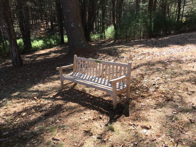
This 1.8 mile walk features Jacobs Meadow and abutting woodlands. Beginning at the entrance gate is a large information kiosk. The trail continues uphill on a mowed trail through a field. At the top of the hill the trail dips down and back up into pine woods. The route continues to the left, past a trail on the right, and continues towards the meadow. Near the bottom of the hill on a small rise above the meadow on the left is a memorial stone dedicated to Helen Burns. On the right is a memorial bench dedicated to Willis Ertman, a former HLCT Board Member. There is also a small kiosk with a trail map. Shortly after passing the kiosk is a trail to the left that heads towards a gully. Follow this trail a short distance and it will turn uphill to the right over a 2-3 foot rise. Follow this through woods continuing to the right. The trail will turn right through a stone wall and after a short distance turn left back through the wall. After approximately a quarter of a mile the trail will turn right through the woods and return to the east end of the lower meadow. As it approaches the meadow there is a Conservation Commission sign identifying the property boundary. Follow the trail to the right through the lower meadow back to the upper meadow and the rise by the memorial bench. Continue left past the bench to the next trail. This trail leads south across rolling hills. Where the trail splits, turn left and continue east. At the trail kiosk at the next juncture continue to the right. The trail becomes rocky and steep and crosses a seasonal stream, as it turns to the right (south). Continue to the right as the trail circles wetlands. After the trail loops to the right (west) it will go back across the seasonal stream. Continue west as the trail rises up a hill to another trail juncture and map kiosk. To the left the trial leads to South Pleasant Street. To the west is Glad Tidings Rock, the site of the ambush of John Jacobs during King Philip’s War. Turn right at the kiosk and the trail goes down a short slope to another juncture. Turn right at the juncture toward the east. This trail goes back to a trail kiosk previously passed. This time turn left at the kiosk heading downhill for a short distance to Jacobs Meadow. Turn left through the meadow and walk between the memorial bench and the memorial stone and back to the entrance gate.

Recommended Trail Activities: Running, Walking, Hiking, Trail Biking Length: 1.8 Route Type: Trail (Narrow), Path (Medium) Difficulty (Grade/Surface): Moderate Parking: Limited Dog Restrictions: Allowed Ancillary Activities: Cross-country skiing, Snowshoeing, Horses (permission may be required), Birding, Hunting (permission may be required), Camping (permission may be required), Picnic


