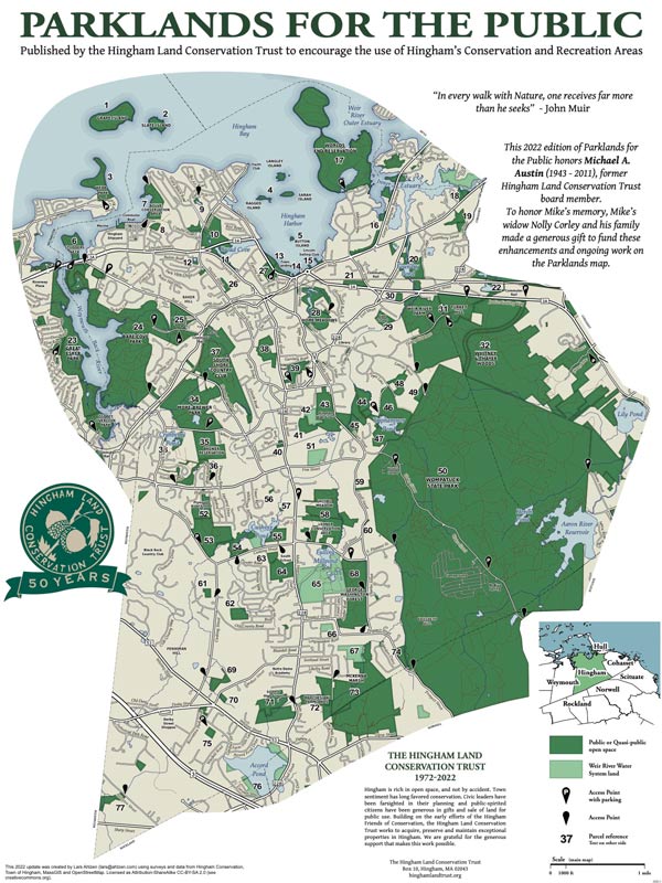
This fifth edition builds on the work of others over the past forty years. In 1970, the Hingham Conservation Commission published a charming freehand map of Hingham today also has many more miles of roads; however for visual simplicity the base map for “Parklands for the Public” continues to be the 1974 highway map. Do not try to use this as a modern roadmap to navigate Hingham streets!
Open Areas in the Town of Hingham including 21 open space areas. In 1982, Phil Swanson, Francis Wylie and John Richardson produced the first HLCT “Parklands for the Public” map, including descriptions of 65 open space parcels. The map was revised and reissued in 1985 for Hingham’s 350th anniversary, and again in 1995 and 2003. Now, the land trust is pleased torecognizeHingham’s375th Anniversary and to honor Hingham’s long-time friend of conservation, Mary Niles, in the new 2010 edition.
Hingham has changed in many ways since our first map in 1982. Much open land has been lost to development, but much has been preserved: notably, Turkey Hill; Weir River Farm; Triphammer Woods bordering Triphammer Pond; a 100 acre addition to Wompatuck Park; and the South Shore Country Club. Thus we have preserved some of the great examples of Hingham’s landscape heritage: expansive coastal views, ponds set in idyllic woods, and rolling pastoral fields and meadows.
Since 2003, Hingham has conserved an additional 65 acres (25 with Community Preservation Act funds). Most new acquisitions are adjacent to conserved properties, adding to existing greenways and resource protection. Noteworthy new additions include the Mobil station site on Hingham Harbor (14); historic Cushing Meadow on East Street (30); Amonte Meadow (20) & Porter’s Cove Point (16) in the Weir River ACEC; a 3 acre addition to the Town Hall Recreation Area donated by the Reed family (39); a 5 acre addition to More Brewer Park donated by the estate of Gertrude Higgins; 14 acres adjoining Brewer Reservation donated in conjunction with the development of Ridgewood Crossing (36); and 14 acres along the Old Swamp River in south Hingham (77). All numbered properties are described on the map’s reverse side.
We hope the map encourages the citizens of Hingham to get out and enjoy the open areas of Town and to appreciate the foresight of Hingham landowners who made this possible by their contributions.

