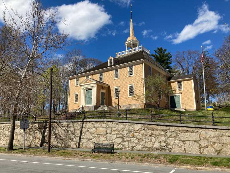
As with other early coastal settlements the village was centered around a meeting house which served as the community church and the center of town government. Typically, the burying ground was located near the meeting house. Hingham’s first meeting house on Main Street was established in 1635 and was later replaced by Old Ship Church. Old Ship Church, built in 1681, is the oldest church in continuous use in the United States.
The walk route passes through two historic districts: bachelors Row and Pear Tree Hill, and Hingham Center Local Historic Districts. More information on the historic districts can be found on Hingham’s web site: https://www.hingham-ma.gov/337/Historic-Districts-Maps-Documents .
The walk begins in Hingham Square, at Main and North Streets, and proceeds southeast past a number of historic structures, loops around Hingham Center and returns to Hingham Square.
In the 1600’s the Common at Hingham Center was an extensive area used as a training field for the militia. The common generally included the area bounded by Main and Pond Streets on the west, Pleasant Street on the south, Spring Street on the west and Leavitt Street on the north. In approximately 1675 the Town built a third fort on the Common for defense during King Philip’s War. In 1744 the extensive area was no longer needed as a militia training ground. The Town granted the land back to its original owners. Exceptions are the parcel bounded by Main, Common and School which remains the common and a parcel bounded by School, Spring and the cemetery fence which is jointly owned by the Town and the Cemetery. In 1896 Hingham Street Railway Company began operation of an electric trolley service on Main Street between Queen Anne’s Corner and Hingham Square. The service had connections to Melville Gardens, Hull and Weymouth.
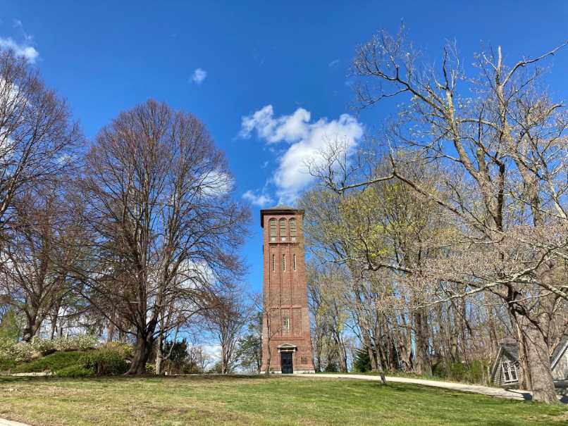
Crossing South Street, the walk continues into the Bachelor’s Row – Pear Tree Hill historic District and goes past a hill on the left. The original Derby Academy, which was built in 1818, sits on the side of the hill. Further along Main Street across from Elm Street on the hill on the left side of Main, the route passes the Old Ship Church. built in 1681. Old Ship is the oldest building in ecclesiasctical use in the country. To the rear of Old Ship Church is a Memorial Bell Tower built in 1912 to commemorate the 275th anniversary of the arrival of Hingham’s first settlers. Behind the Bell Tower is the site of Hingham Cemetery, the Town’s first burial ground (1635-1685). The cemetery was also the site of one of three forts in place in Hingham in 1675 during King Philip’s War.
In early colonial times the northerly side of Main Street was separated from the southerly side and rose up following the contour of the hill. In the 1600s early settlers were buried on the hill by Main Street. In 1831 the area of the hill adjacent to Main Street was removed and the level part of the street was widened to include the northerly lane, as it’s configured today. Bodies were disinterred and reinterred on the site of the old fort. Some were reinterred in the Hingham Center Cemetery.
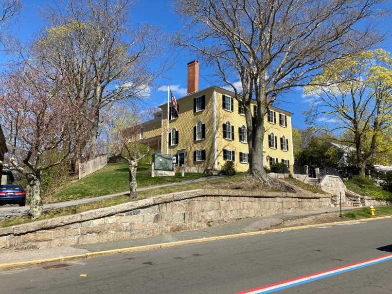
The route continues southeast on the left (north) side of Main Street through the Bachelor’s Row and Pear Tree Hill Historic District, passing historic houses at 126, 136 and 144 Main Street.
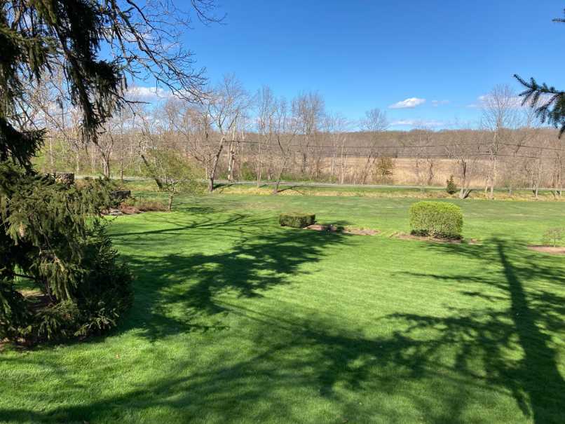
At the corner of Water Street, the route turns right taking the crosswalk to the south side of Main Street then turns left continuing southeast along the sidewalk. On the corner across Main Street is St. John the Evangelist Church built in 1919. Continuing downhill to the corner of Main and Winter Street on the left, is a sign identifying the open space on the left side of the street as the Home Meadows. These meadows were used by early settlers for harvesting salt hay to feed their livestock.
Passing Home Meadows Lane, the walk climbs up Pear Tree Hill. The route passes a number of historic properties in the Pear Tree Historic District. Near the top of the hill Main Street intersects with Garrison Road on the right and Leavitt Street on the left. Turn left across Main Street, right across Leavitt Street then turn left onto the sidewalk under Hingham Center’s iconic “Buttonwood Tree.” The “Buttonwood Tree” was planted by Daniel Souther in 1791 and is purportedly one of the largest Sycamore Trees in the state.
Leavitt Street was named for Deacon John Leavitt, who, with John Smith, in 1665 had been granted 12 acres on Turkey Hill by representatives of the Town, with the agreement that they pay the Wampanoags. an amount agreed upon by the Town representatives and Wompanoag Sachem Josiah Wompatuck. The amount agreed upon with the Wampanoags was for rights to the land in Hingham.
The route continues east on Leavitt Street to the corner of Short Street. This is the location of an Alms House which provided shelter for the poor. The Alms House, built in 1785, had separate doors for men and women. It was raised in 1962.
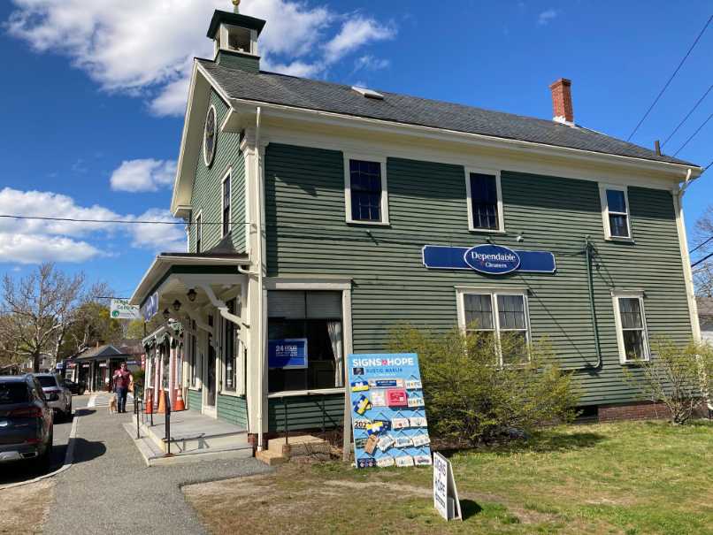
The route continues across the crosswalk to the east side of Short Street and turns right to the front of J F Orr and Son Cabinet Makers at 8 Short Street. The building is the original Center School which was moved to this location from a nearby site on School Street. The original school building had become outdated and was replaced by a newer Center School. After the building was relocated it became the Central Fire Station. When the fire station was moved to Main Street the building was used by the Tree and Park Department. Currently the building is used by J F Orr and Sons Cabinet Makers.
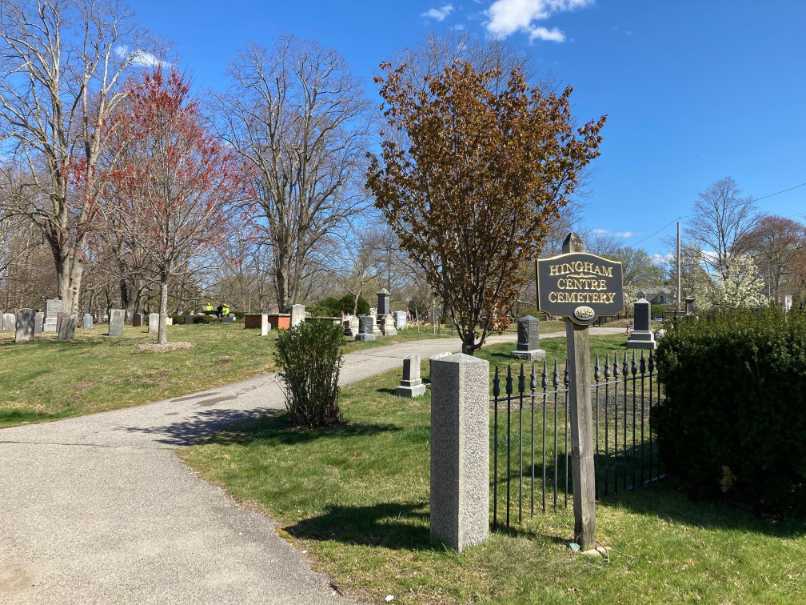
Continue on Short Street and turn left into the Hingham Centre Cemetery which was established in 1684. Follow the main path to the right. When Main Street was widened in Hingham Square at Hingham Cemetery in 1831 some identifiable remains were brought to Hingham Center Cemetery and reinterred.
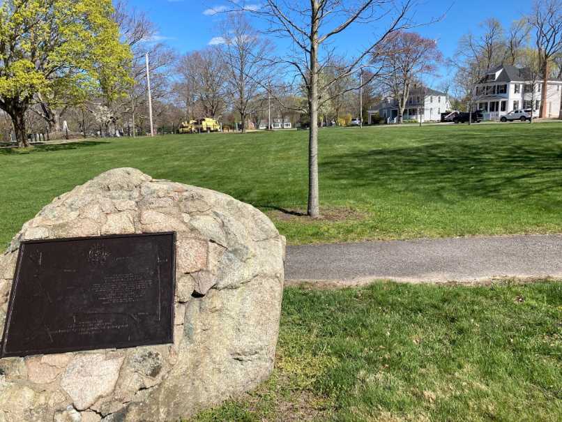
After walking through the cemetery for a short distance, turn right through an opening onto a lawn area and cross School Street onto the Common. The current common is what remains of a much larger common in the sixteen hundreds. Walk across the common to a stone marker near the sidewalk on Short Street. The marker has a map of the original common area. The common then extended to Pleasant Street on the south, Spring and School Streets on the east, Leavitt Street on the north and Main Street in the west. One of three forts built in Hingham for defense during King Philip’s War was located on the common in the 1670s.
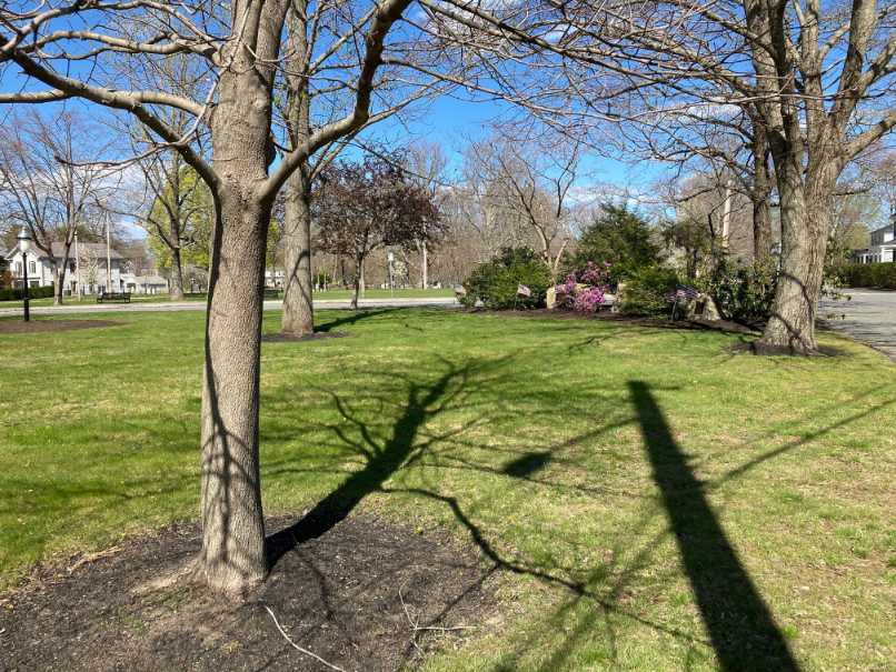
On the block to the left bound by Main, Middle and Common Streets is Veterans Memorial Park. The park features memorial stones dedicated to the veterans of World Wars I and II and the VietNam War. The Park was the site of Hingham’s second public library, which was demolished in 1966 after the opening of the current library at the corner of Leavitt and East Streets. Turn right on Short Street to the midwalk crosswalk between Middle and School Streets. Turn left crossing Short Street.
Crossing Short Street, the route goes to the east side of Main Street and continues right (north). After crossing the alley (or extension of School Street) there is a building with a group of shops which was one of the Town’s Post Offices around 1900. The route continues past the Buttonwood Tree and crosses Leavitt Street. The route then turns left crossing to the west side of Main Street. The route turns right and continues north on Main Street, down Pear Tree Hill, crossing Home Meadow Lane and passing historic homes on the left.
After passing the intersection with Water Street we come to Tranquility Lodge on the left at 137 Main Street, built in 1767. The house was named for Tranquility Grove which was famous for social and abolitionist gatherings. Further along on the left at 107 Main Street, is the Old Ship Parish House built in 1867.
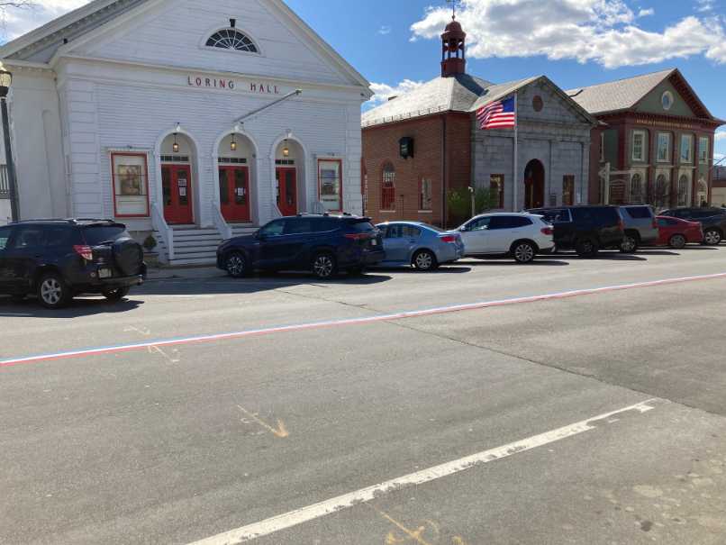
The First Baptist Church built in 1828 at the corner of Elm and Main Streets, was the first non-Unitarian Church building in town. Loring Hall was built in 1852 to serve as a meeting place and a location for performances. The lower level was used for dining and the upper level was the hall. The walk ends at the Hingham Institution for Savings, the country’s 18th oldest bank, established in 1834. The bank building, which was the first quarters of Hingham Mutual Fire Insurance Company, was built in 1860. Having returned to Hingham Square this concludes our walk.

Recommended Trail Activities: Walking Length: 2.5 miles Route Type: Path (Medium) Difficulty (Grade/Surface): ADA Compliant, Easy Parking: Adequate Dog Restrictions: Leash Required Ancillary Activities: Historic Sites
