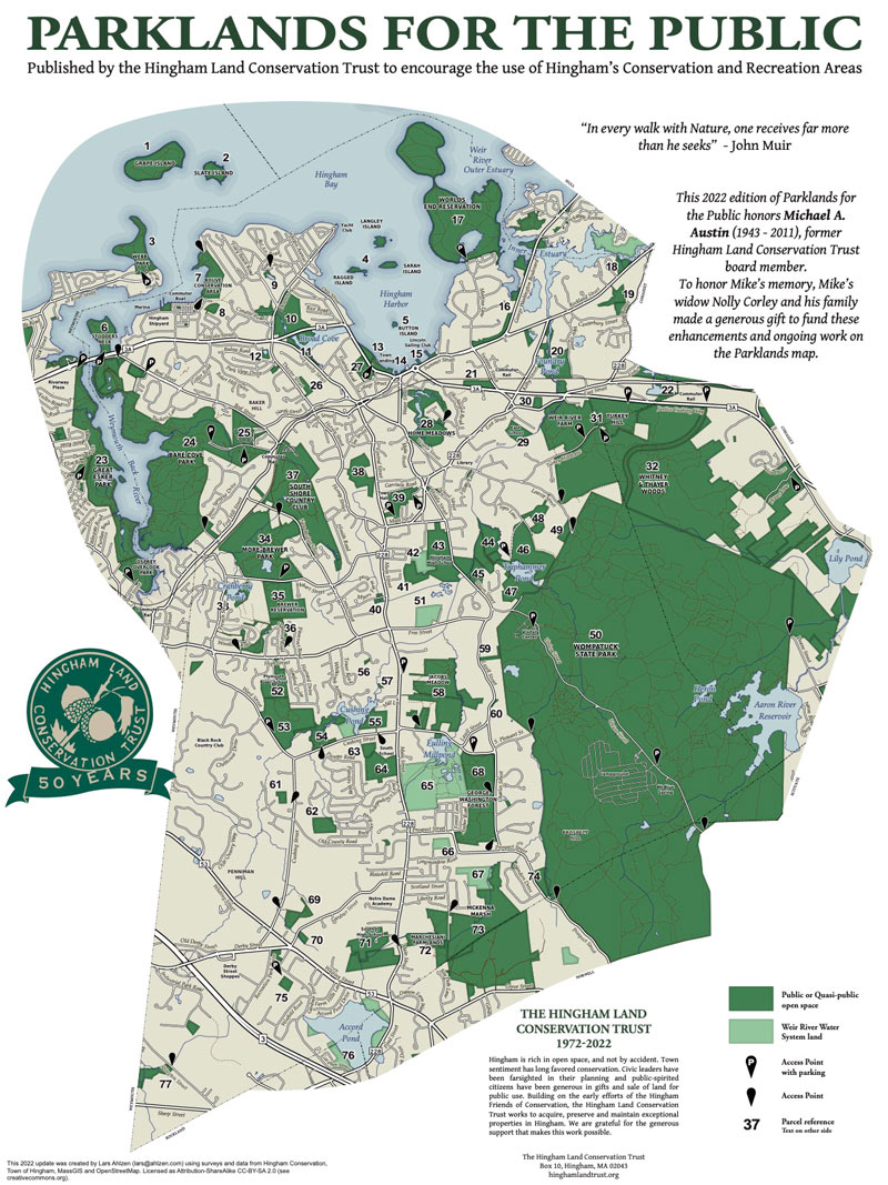
The Plymouth River Complex is located on the east side of Ward Street between High and Cushing Streets. Look for the Margetts Field sign at the entrance to a parking lot and athletic field. Drive toward the left side of the parking lot and then turn right into a second parking lot toward a second athletic field. Drive to the far end of this second parking lot and park in the northeast corner of the lot, furthest from the street, in front of a black chain link fence. Walk to your right along the fence. At the end of the fence, turn left and walk along the side of the athletic field to begin the 0.92 mile walk. GPS coordinates 42.20609818589366, -70.90213792823546
In a few hundred feet turn right on the trail down a slope and across a stream. The stream flows from the north into the Plymouth River. The surrounding land is in the Weir River watershed and the flow eventually ends up in the Weir River. Stay right on the well-defined trail as it continues east and then north around a small hill. The trail provides for a pleasant walk amid woods of pine and oak trees. When you approach neighborhood housing on your right you will turn left at a fork in the trail. This section of the trail will continue around the hill along the stream on your right. You will turn right and cross back over the stream and continue up the slope back to the edge of the athletic field. Turn right and follow the trail at the edge of the field to the northwest corner of the field where you will enter the woods. Walk through the woods, passing over a stream, until you approach the back of the Plymouth River School. Look to your right for the entrance to “Storybook Trail” with interpretive boards describing the flora and fauna in the woods. At the end of the interpretive trail, stay to the right and walk along the trail behind a residential area. When you reach the end of the interpretive trail stay to the right, and in a short distance, turn right again repeating your walk along the hill with the stream on the right and turning right, across the stream and back to the field. At the field turn left and back to the parking lot.

Recommended Trail Activities: Walking, Hiking, Trail Biking Length: .9 Route Type: Trail (Narrow) Difficulty (Grade/Surface): Easy Parking: Adequate Dog Restrictions: Allowed Ancillary Activities: Cross-country skiing, Snowshoeing, Birding, Hunting (permission may be required), Camping (permission may be required), Picnic