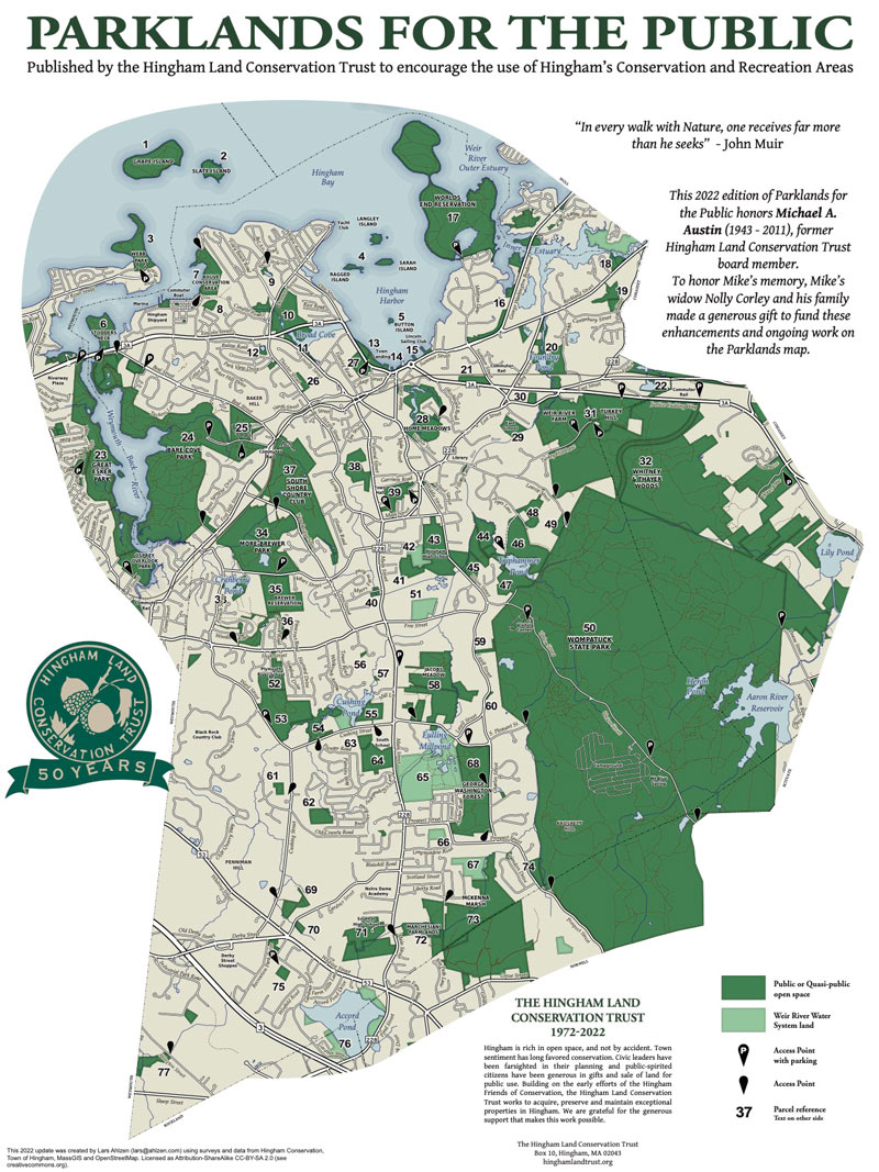
Encompassing 3,500 acres (1540 in Hingham), this heavily wooded park is one of the town’s greatest conservation assets. It stretches into four towns – Hingham, Cohasset, Scituate and Norwell. The park falls inside the area bound by land in Hingham and Norwell in the west, Hingham and Cohasset in the north, Cohasset and Scituate in the east and Norwell in the south. In the west, Prospect street in Norwell and residential property east of Prospect, Charles, Lazell and Free Streets; Triphammer Woods and Triphammer Pond Conservation Land; and a mix of residential and conservation land north of Triphammer Pond, in Hingham and Cohasset form the boundary. On the north, Whitney and Thayer Woods and Town land in Cohasset form the boundary. On the east Brass Kettle Conservation Area and residential land west of Doane and Church Streets in Cohasset and west of Summer Street and north of Clapp Road in Scituate form the boundary. On the south residential property north of Mount Hope Street west of Mount Blue Street and north of Grove Street in Norwell form the boundary.
The terrain of the park is extensively shaped by the glacial period. Prospect Hill, near the southwest corner of the park, is the highest point in Hingham at 240’ above sea level. Mount Hope is in the southeast corner of the park, north of Mount Blue, which is south of the park in Norwell. Turkey Hill is north of the park in Cohasset. This park is also the site of a glacial erratic, the Burbank Boulder. This boulder which balances itself at three points equally distant from each other, was left on the earth’s surface by glaciers. The Burbank Boulder is located in the northeast area of the park near Whitney Thayer Woods.
Water features include Cohasset’s Aaron River Reservoir which was created by damming the Aaron which flows east from Holly Pond. Other water features include: Mount Blue Spring, a source of potable spring water, and Woodpecker, Wildcat, and Heron ponds. Accord Brook, which originates in Accord Pond, flows north along the park’s border, from the Hingham-Norwell town line to S. Pleasant Street. The brook continues north to Triphammer Pond and ultimately flows into the Weir River.
Accord Brook is the main waterway through Wompatuck Park. Originating at Accord Pond it flows along the southwest boundary of the park near Prospect Street north to South Pleasant St. It turns east into the park and flows north into and beyond Triphammer Pond and into the Weir River. Other major rivers are Aaron River and Bound Brook which originate near the Norwell border and flow east along Hingham’s borders with Norwell and Scituate into Aaron River Reservoir. The Aaron Reservoir Dam was constructed from 1976-1978. Below the dam, the river continues to flow on to Lilly (formerly Scituate) Pond. From there Bound Brook flows north along the Cohasset-Scituate border to Cohasset Harbor. A third watershed in Wompatuck is Brass Kettle Brook which flows from the base of Turkey Hill to the east along the north border of Wompatuck to Lilly Pond and on to Bound Brook.
This land that we call Wompatuck State Park was originally the property of the Wampanoag Tribe. In 1655, Chief Josiah Wompatuck, leader of the tribe, deeded the land, we now call Hingham and Cohasset, to the settlers from England. (Until 1775 when Cohasset was established as a separate town, it was part of Hingham.) In the 1700s, early settlers and ship captains held title to the area, but the land was never extensively developed. The tall trees were used for masts and stone walls were built to denote survey and boundary lines. During the 1800s, families maintained woodlots to heat their homes. The farmers used the fields to graze their horses, sheep, and oxen. Streams powered the Stockbridge Shingle Mill and water from Mt. Blue Spring was commercially bottled.
When the Civil War broke out all the local men were swept into the fight. Many never returned. In their absence, the land was not utilized and the forest started to reclaim it.
In 1941, the U.S. Navy acquired from private landowners all of the property in order to expand the already existing Hingham Naval Ammunitions Depot. The Annex was known by locals as the “Cohasset Annex”. The Annex was connected to the Ammunition Depot on the Back River, at what is now Bare Cove Park by railroad. There is a rail spur track at each of the sites linked to the Greenbush Line. Many cement bunkers were constructed and the area became a huge munitions storage depot. During World War II the Depot was the main ammunition supply for the North Atlantic naval forces. When World War II ended, this area reverted to maintenance status only. It was reactivated for the Korean conflict and once again went into full military operation. Explosives such as TNT loaded depth charges, bombs, fuses, projectiles, and cartridges were produced and stored along with the assembly of rocket motors. The park site served as the Cohasset Annex until 1962.
Scattered throughout the property are over 100 decommissioned military bunkers, which were used to store ammunition. Explosives such as TNT loaded depth charges, bombs, fuses, projectiles, and cartridges were produced and stored along with the assembly of rocket motors. Many of these bunkers have been backfilled, but some remain exposed, including one which housed parts of the Navy’s first nuclear depth charge in the 1950s. There are several old military buildings on the property, as well as an extensive network of abandoned railroad tracks. The railroad tracks fan out throughout the property from what is now known as the Whitney Spur Rail Trail at the northwest corner of the park. Remnants of buildings can often be found clustered near abandoned rail spurs. Most remaining buildings have had their roofs and windows removed and are open to the elements.
This all came to an end in 1962. The U.S. Navy deactivated the Cohasset Annex and in 1963 the land was declared surplus by the Navy. In 1966 the Commonwealth of Massachusetts took possession of the Cohasset Annex property. In 1967 the Massachusetts Department of Natural Resources purchased the 3496 acres to convert it to a public park.
In 1969 the park opened for limited outdoor recreational use, and in 1973 it was dedicated as Wompatuck State Park. In 1986 the Park acquired an additional 600 acres from the government.
The 1.5mile long Whitney Spur Rail Trail was constructed in 2003 on land owned by the Department of Conservation and Recreation from the MBTA Cohasset Commuter Rail Station parking lot to Wompatuck State Park.
On January 1, 2004, a 125 acre parcel off of Leavitt Street was added to the park. This section was opened to the public in 2014.
The park has a large number of paved roads remaining from its use as a Naval Ammunition Depot. Many of these roads go back to colonial times. Union Street, the main road through the park, begins in Hingham and extends south, all the way through the park, becoming Mount Blue Street as it enters Norwell. Leavitt Street, which once connected Cohasset’s Beechwood Area to Hingham’s Town Hall, extends into Wompatuck and becomes Doane Street at the Cohasset town boundary. South Pleasant Street runs east from Main Street in Hingham to Union Street in Wompatuck State Park. Lastly, Beechwood Street ran east from Union Street through the site of Aaron River Reservoir to Beechwood Street in Cohasset until the reservoir was formed by a dam in 1976-1978.
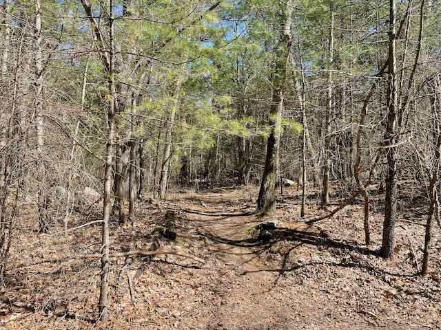
Much of the park is undeveloped and is heavily wooded. It has stands of White Atlantic cedar, American holly, chestnut oak, shagbark hickory, mountain laurel, pink dogwood, white pine, American Beech, and hemlock, some estimated to be 175 years old. Wildflowers and flowering shrubs also grow in abundance. Among the most common are Swamp Azalea, Solomon’s Seal, While Geranium, ladies slipper, and Sheep Laurel.
Land and water creatures abound in the park. Common species include: muskrat, raccoon, cottontail rabbit, skunk, painted turtle, bullfrog, coyote, deer, bobcat, fisher cat, red & grey fox, yellow spotted salamander, yellow spotted turtle, box turtle, woodcock, bass, pickerel and sunfish. There are over 250 bird species in the park, including : blue jay, great blue heron, goshawk, red tail hawk, yellow warbler, ruffed grouse, and quail. Fish commonly found in the 136-acre Aaron River Reservoir include bass, pickerel, sunfish, and perch.
The park features approximately 400 seasonal campsites, plus fishing, non-motorized boating and seasonal ice skating on the Aaron River Reservoir. There are 12 miles of paved bike paths, plus off-road trails for hiking, dog walking, horseback riding and cross-country skiing. Stroller-friendly in some sections. For mountain bikers, the park is home to one of the longest sections of switchbacked singletrack in the state. The Wompatuck Trail is ADA accessible.
The Visitor Center is accessible from the Union Street entrance. More about park features and permitted uses can be found at mass.gov/locations/wompatuck-state-park.
Leavitt Entrance
The area of the Leavitt Street entrance is characterized by Leavitt Street and the Whitney Spur Rail Trail. Leavitt Street, which continues into Doane Street and into Cohasset’s Beechwood area. Until 1775 Cohasset was part of Hingham, referred to as the second parish. Doane Street was created at the initiative of Doane to make it easier for second parish residents to attend Hingham town meetings at the corner of Leavitt and East Streets. The Doane Street creates a direct connection between East Street in Hingham and the Beechwood area in Hingham’s second parish (Cohasset).
The Whitney Spur Rail Trail was built as part of the Greenbush Commuter Rail reconstruction project in 2003. Initially the rail spur was constructed in the 1940s to link the US Naval Ammunition Depot Annex ( Wompatuck State Park) to the Naval Ammunition Depot, which is now Bare Cove Park. The rail spur connected the two sites by way of the Greenbush Rail Line. The rail spur entered the ammunition depot at its northern boundary near Leavitt Street and served military warehouses, a cluster of which were in the area of the spur and Leavitt Street.
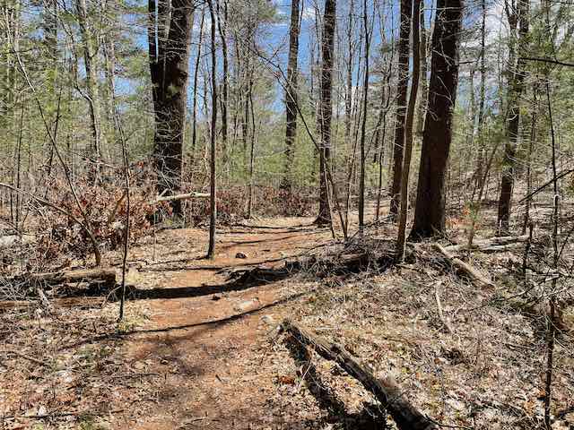
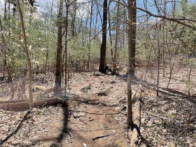
Most of the 2.25 mile hike is up and down hills through the woods on uneven trails covered with rocks and tree routes. It is best suited for hiking and trail biking.
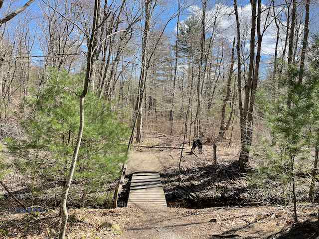
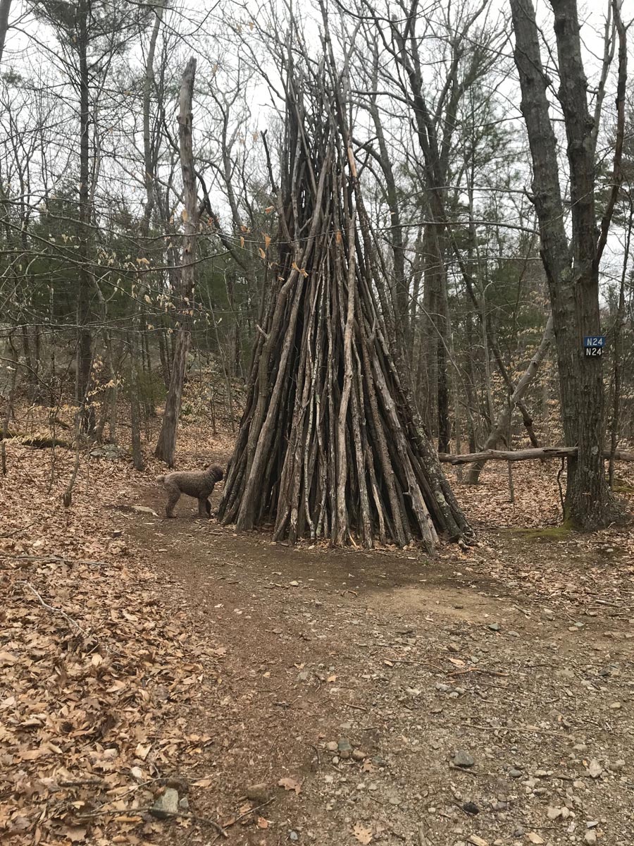
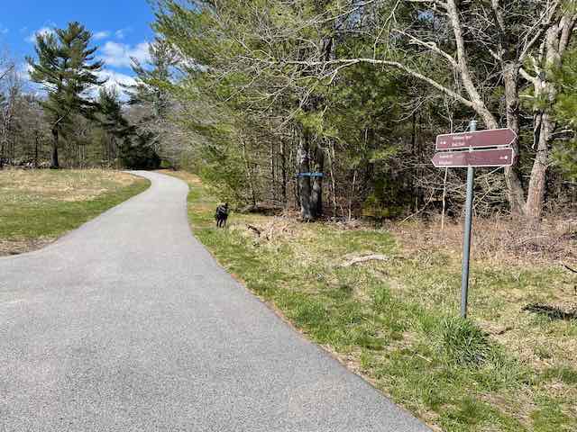
Entering the park from Leavitt Street turn right onto the trail across from marker NN3. This trail goes through thick woods and has a rough surface covered with rocks and tree routes. The trail continues left at marker NN2 and goes downhill to a paved road. The route crosses the road at marker NN1, crosses a wooden bridge over a stream which flows toward Accord Brook. After crossing the bridge the trail ends at a path on an abandoned rail bed. Turn right on the path and in a short distance turn left at marker N16 onto a trail that leads uphill into the woods across rocky woodlands. Bear right at marker N17,and continue over the top of the hill and stay right going downhill. The trail loops left and bears right at N21 and follows the trail to marker N22. At N22 the trail comes to the edge of a field with a road beyond. The field appears to have been created by demolishing and burying a military warehouse. The route turns left along the edge of the field, turning left again near the end of the field onto an unpaved road back into the woods. The road narrows to a trail and comes to a four corner trail junction at marker N24. (Note a large wood branch teepee.) Continue turning left at N24. At N23, the next juncture, turn left continuing to N19 and take a sharp right to N18. (Note trails in this area are subject to seasonal flooding.) Go straight at N18 and straight again, on a path along abandoned railroad tracks at NN14. Then the trail crosses an open field and meets Leavitt Street at marker NN12. The route turns left onto Leavitt Street, past a field on the left, and continues past markers NN11 and NN3 and returns to the Leavitt Street entrance.

Recommended Trail Activities: Hiking, Trail Biking Length: 2.3 miles Route Type: Trail (Narrow), Path (Medium) Difficulty (Grade/Surface): Difficult Parking: Adequate; heed posted signs regarding parking as the school bus uses the circle for turning around and police will ticket drivers parked during school hours Dog Restrictions: Allowed Ancillary Activities: Horses (permission may be required), Birding, Hunting (permission may be required), Camping (permission may be required), Picnic, Snowmobiles
