John Brewer, became owner of the land in the 19th century. He built a mansion here in 1856 and established a farming estate. Over the next 30 years, he acquired most of the peninsula’s 400-plus acres. He made plans to build a 163-house residential subdivision (designed by Frederick Law Olmsted, the father of American Landscape Architecture) in 1890. The carriage roads were constructed, and trees were planted. The homes were never built, but some of the carriage roads are still in place. The property was also strongly considered as a location for the United Nations Headquarters in 1945, and a nuclear power plant in 1965, but these proposals were never implemented.
In 1967, thanks to the tremendous local commitment and fundraising efforts, The Trustees of Reservations (TTOR) and dedicated residents of Hingham and surrounding communities were able to preserve this special place.
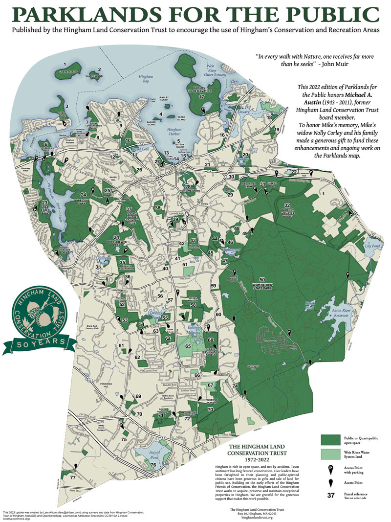
The largest property in Boston Harbor Islands, World’s End and its 4.5 miles of Olmsted’s well maintained carriage paths and footpaths draw many on weekends to enjoy the fields, which are attractive to butterflies and nesting birds. In addition to the fields and birds there are woodlands, rocky shorelines, drumlins, marshland and granite ledges and plenty of red cedar and blueberry bushes. The drumlins and cliffs offer beautiful views of the surrounding waters and the Boston skyline.
Planters Hill is crowned with three rings of trees and a circular path. A flat grassy area stands on the top of the hill. From the summit there are views in four directions: south, across the sprawling fields of World’s End; west, to Hingham Harbor and the wooded, suburban towns; east, beyond the rocky bayside cliffs to hundreds of cottages along the narrow arm of the Hull peninsula; and north, to Boston, the Harbor Islands, and Massachusetts Bay.
thetrustees.org/place/worlds-end-hingham and click on “Admission and Hours.” An annual horseback riding permit is required for those riding horses.
The 2.4 mile winding walk starts with a clockwise loop from the bridge at the entrance left around the harbor side of Pine Hill Drumlin back to the bridge. It then goes along the west and north sides of Damde Meadows turning northeast across Weir River Road and onto a counter clockwise, waters edge loop around Rocky Neck. Returning to Weir River Road, the route turns left and follows the road back toward the parking lot. On the way it takes a right turn through a woodland trail, along the edge of the meadow, and left across a field back to the road then a right to the parking lot. While most of the route uses gravel roads and grass paths most of the trails on Rocky Neck are narrow, steep and rocky.
The walk begins at the parking lot turning left onto the stone path at the north end of the lot away from the entrance road. The route bears right (north) uphill turning right off the road at the top of the hill. The route goes through a clearing with a picnic table, benches, a split rail fence and an overlook, before turning left and going down hill. The trail turns sharply to the right onto the entrance road and passes a stone wall, Hingham Harbor and a tidal marsh on the left and a granite bench, an information kiosk and a rangers shed on the right. The road continues across the bridge and turns left onto a trail. Depending on the season and time of day you can observe fish swimming under the bridge and seabirds on the water.
After stepping over a storm drain, the trail leads past a field on the right and an inlet on the left that connects to Damde Meadow. Facing a stone wall in front of Hingham Harbor, the trail turns right then rises uphill with the harbor on the left and a Pine Hill Drumlin field on the right. Continuing up the hill the trail passes cedar trees and crosses a stone wall. While passing maple and beech trees the rising trail becomes smooth. After leveling the trail passes birch and oak on the right at the edge of the drumlin field. The trail comes to a tree-lined stone wall dividing two fields on the right with a grass covered trail on the near side of the wall. To the left are views of the harbor. The route then turns right up the drumlin with the tree lined wall on the left. At the top of the hill the route turns right onto the gravel surfaced Brewer Road. The tree-lined road goes over the top of Pine Hill Drumlin with harbor views, and gradually descends down hill past trees with name labels. Near the bottom of the hill before the bridge, there’s Barnes Road, on the left.
The route turns left onto Barnes Road passing grasslands on the left and woods and Damde Meadow on the right. The road crosses a pipe drain, fields uphill on the left trees downhill on the right. The road curves left, passing an entrance path to a pond side, open air nature center on the right. It then passes a stone wall that goes up and downhill on either side of the road. As the road continues there are fields rising up the side of the Planters Hill Drumlin on the left and fields leading to the Damde Meadow on the right. Turn right onto the tree lined mowed trail that splits the fields on both sides of the road. Follow the trail, through a stone wall and into the woods beyond. As the trail splits stay to the right and walk up to the top of the rock outcrop and enjoy the view on the right back over Damde Meadow. Turn left and follow the trail over the outlook to a T intersection. Follow the trail on the left downhill and where it joins another trail and continue to the right. The trail passes woods with boulder out crops on the right and a stone wall and field on the left. The wall ends and the trail continues through woods to a T intersection with a road, Weir River Road. Turn left on the road then immediately turn right onto a dirt road.
The road passes trees with a clear underbrush on the left and wetlands on the right. After passing a trail on the left, the left side of the road rises and turns into a rocky outcrop. When the road comes to a pond and another road on the left bare right. The road rises and curls left with an outcrop on the left and a trail on the right. The route goes right onto the trail leading to the edge of the Weir River. At the next juncture stay right and go down steps with an outcrop on the left and the river on the right. Pass a trail down to the beach on the right. There are views of Nantasket across the Weir. Stay left at the next juncture to avoid the narrow rocky trail on top of ledge. At the next juncture there is an outcrop on the left and a dirt road on the right with more views. Continuing right on the road there are woods on the left and the river on the right as the trail passes an overlook and a rocky trail on the right. The route stays left to avoid the rocky trail. There are more views and another rocky road on the right.
There continue to be viewing opportunities both from the trail along the water’s edge and from dead end trails out to points on the right of the trail. The next dead end has views of Sunset Point in Hull and after that views of World’s End. Trail overlooks offer views of both World’s End and Sunset Point, then views of World’s End and Planter’s Hill. The trail drops and offers another view of Planter’s Hill and World’s End. The rocky trail rises with views of World’s End and Hull. Following the trail downhill through 2 junctures to the right the trail comes to a small cove with a rock wall on the left side providing striking views of the rock wall, the cove and beyond. The trail loops to the right up the rock wall and continues to a peak with an outcrop on the left with views of World’s End and Nantasket. The rough, rocky trail continues downhill to a juncture on the left. The route continues right with a wet area on the left followed by a hill and a rise to a rocky outcrop. The trail drops several feet to another trail juncture and the route turns to the right onto an overlook loop. At the end of the loop is a view of the Hull coast to the right. Returning to the main trail there’s a view of the isthmus between Planters Hill and World’s End. Turning right back onto the main trail the slope flattens then rolls down hill through woods to Weir River Road.
Turning left onto Weir River Road the route passes a field on the right and an elevated rocky outcrop with woods on the left. The road then passes through woods and outcrops on both sides followed by a trail on the right and trees with no undergrowth followed by the road to Rocky Neck on the left. Continue straight on Weir River Road pass by marsh and over an earthen dam with views of the Weir River on the left and Damde Meadow on the right. The road turns right going past an outcrop on the right and comes to a trail on the right. The route turns right onto the trail passing between rocky outcrops then curves left with Damde Meadow on the right. The route goes through a mowed field along Damde Meadow and turns left across the field and back to Weir River Road. Turning right on the road the route leads back to the parking lot at the park entrance.

Recommended Trail Activities: Walking, Hiking, Trail Biking Length: 2.4 miles Route Type: Trail (Narrow), Path (Medium), Road (Wide) Difficulty (Grade/Surface): Moderate, Difficult Parking: Adequate Dog Restrictions: Leash Required Ancillary Activities: Horses (permission may be required), Birding, Boating, Fishing (license may be required), Picnic, Historic Sites